Summiting Pikes Peak: Barr Trail
One of Colorado's 54 fourteeners, Pikes peak rises to 14,100 feet, with awe inspiring views as it towers over Colorado Springs. Hiking Barr trail will take you thirteen miles from the edge of Manitou Springs to the summit of Pikes Peak. Having never hiked a 14'er previously, my girlfriend Jane and I decided to undertake the challenge, it would turn out to be a worthy opponent indeed. Little were we aware that we would get stuck in a thunderstorm, experience weather ranging from the upper 80's to snow flurries at the summit, seek shelter under a boulder, miss our ride down, and that I would get altitude sickness. However, the sense of accomplishment, spectacular views, and shared experience with someone I love dearly made the trek worth it. Truly an adventure.
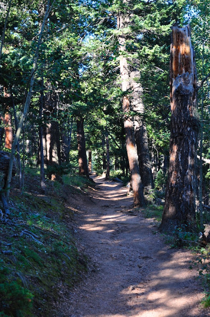
We left the trailhead at 5:40 AM. The morning was brisk but not too cold and all signs indicated it would be a beautiful day. The first part of the trail is a long series of switchbacks that are well maintained and easily navigable. The first section is rather steep and you will gain elevation quickly. In the twilight it provided a serene view of Colorado Springs in the distance. The first two miles awarded us with an inspiring view of the sunrise.
A few days prior to our hike, the annual Pikes Peak Marathon had taken place. For us this was great because it left signs to regularly let us know how far we had trekked. However, these were only up for a portion of the day unfortunately, as later we would encounter a volunteer making his way down from the summit picking up the signs.
With just over 10 miles still to travel, we were afforded our first view of the summit.
Jane standing in "The Passage". Here the trail goes under a group of boulders.
It was interesting to find this lean to along the trail. The cuttings were relatively fresh, and we had to wonder if someone had spent the previous night here.
Halfway!
My beautiful girlfriend Jane next to a Ponderosa. Next time you see one smell it. I am not kidding, they smell like vanilla.
Barr Camp: provides weather information about the summit, food and drink for sale, water filters to rent, and picnic tables and benches to rest.
For $3 we rented a water filter and refilled our water bottles in the nearby spring.
By the time we were both getting quite warm. Jane was lucky enough to be able to go to a tank top. We both had wished we had brought shorts to change into.
This would be the last sign we would see left from the Marathon.
10 miles down, 3 left to go. Little did I know at the time these three miles above the timberline would be the most difficult 3 miles of my life. It is at this point that altitude sickness started kicking in for me and slowed our pace considerably.
View of Colorado Springs in the distance. You can also slightly make out the Garden of the Gods.
How I even managed this half-smile is beyond me. At this point I was experiencing severe dizziness, headaches, and shortness of breath. At minimum I had to stop every hundred yards and had to rely on Jane to assist me often when I felt I was losing my balance. I am incredibly grateful.
Marmots were everywhere at this elevation
Approaching storm.
Within a few miles we went from wishing we had shorts on to adding several layers. It was cold.
The Cirque.
At this point we had to put the camera away for over an hour to keep it from getting wet. During that time we were forced to seek shelter under some boulders for fear of lightning during the thunderstorm. Following the thunderstorm it hailed lightly, and then we saw flurries.
The top met us with a herd of Big Horn Sheep Ewes.
View from the summit looking over Colorado Springs.
We made it!
For perspective on our hike, this is the view of Pikes Peak from Colorado Springs.
Closing Thoughts: For two flatlanders from Kansas this proved to be a very difficult yet rewarding hike. It is a gorgeous mountain and commands your respect. I will never forget all the adventures and misadventures we had on the slope. The only let down for me was how commercialized the top was. With both a road and train route to the top, the summit is not nearly as serene as it otherwise could be if there wasn't a gift shop pandering trinkets in the periphery. That being said, it was still worth it and both Jane and I did not mind having cool refreshments and hot doughnuts to enjoy after a very long day. The hike is long for a 14'er and combined with the high altitude we were pretty wiped out. For me it was even more difficult as I was symptomatic of H.A.C.E. Will we do another 14'er? You bet, I have already researched several but I think next time we will be slightly more prepared and will choose a shorter route. Perhaps Quandary, Lincoln, or Bross will be next. Credits for photos are shared between Jane and I.


6 Comments:
Post a Comment